Mapping HCH contaminated soil and sediment
One of the applications of the gamma-ray spectrometers of the MS-series is in mapping the HCH contamination of soil and sediment.
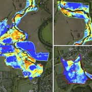
In a previous post, we described the mapping of soils contaminated with polychlorinated dibenzodioxins and furans (PCDD/F) in the floodplains of the Spittelwasser area in Saxony-Anhalt, Germany. This area is a part of the Elbe river basin and it is highly contamined through waste water formerly discharged from the near-by Bitterfeld-Wolfen industrial mega site. This project was conducted for Landesanstalt für Altlastenfreistellung(LAF) in collaboration with Tauw Germany. The project that initially focussed on mapping contaminants by a quad-borne survey, was extended by mapping part of the river with an underwater gamma-ray spectrometer and by using a drone.
The results of this project are now published in a paper written bij Tauw. This paper provides background information on two pilot sites covered by the “HCH in EU” project to explain the challenges faced, the successes achieved and the importance of contaminated site management.
The paper can be downloaded here.


