Amerikaans ministerie van Defensie gebruikt Medusa methode om waterbodems te karteren
Medusa Explorations en Partrac GeoMarine hebben een 3-jarig contract gewonnen bij het Amerikaanse ministerie van Defensie (Department of Defence, DoD).
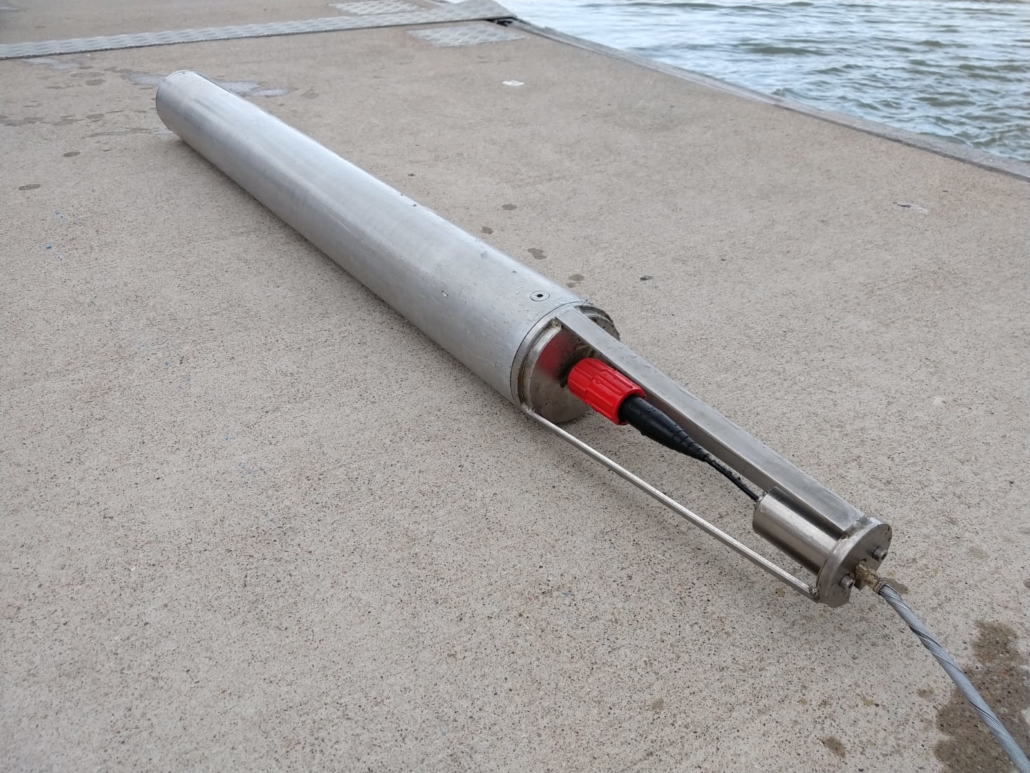
Vernieuwde onderwater gamma spectrometer
Dit project heeft tot doel om te demonstreren dat met de onderwater gamma-spectrometer verontreiniging van waterbodems in beeld kan worden gebracht. Deze aanpak heeft Medusa Explorations vaker toegepast in Nederland en Europa. Met de nieuwste ontwikkeling en innovaties van onze sensoren kan deze technologie ook in Amerika worden toegepast.
Voor het DoD zullen Medusa en Partrac 3 demonstratieprojecten gaan uitvoeren op locaties waar verontreiniging van de waterbodem is aangetroffen.
Engelstalig persbericht
Partrac GeoMarine awarded 3 year U.S. Department of Defense contract to demonstrate new tool for the in situ mapping of contaminated sediments.
Technology expected to offer significant cost, safety and environmental benefits pre- and post-remediation of contaminated sites.
Houston, June 27th 2019. Partrac GeoMarine Inc., the Houston based Marine Survey and Consultancy company, are pleased to announce the award by the US Department of Defense (DoD) of a 3-year contract to demonstrate a new tool for mapping the in situ distribution of Contaminants of Concern (COCs) in aquatic sediments. The award is part of the Environmental Security Technology Certification Program (ESTCP), the DoD’s environmental technology demonstration and validation program.
Partrac, together with its Netherlands based partner Medusa Explorations, will deploy the new instrument at up to three contaminated DoD Superfund sites to map the distribution of COCs such as Polycyclic Aromatic Hydrocarbons (PAHs), Polychlorinated Biphenyls (PCBs) and heavy metals, e.g. mercury, lead, zinc.
Dr. Patrick Friend, Partrac GeoMarine’s Business Development Consultant (Americas), said “We are really excited to be bringing this new instrument over from Europe to be used in the US. This technology is a potential game-changer in the way that contaminated sediments are mapped, and can offer significant cost and safety benefits over traditional contaminated sediment sampling and mapping methods”.
Dr. Ronald Koomans, Director of Medusa Explorations B.V. said “We have trialed this technology in Europe over the past few years, and have successfully mapped the distribution of contaminated sediments in ports, harbors, and rivers – the Port of Rotterdam and the River Elbe, for example. We can use the tool not only for new site investigations, but also for post-remediation monitoring of sites that have been capped, for example, to test capping efficiency.”
The new instrument coming to the US is a specially adapted aquatic gamma spectrometer developed by Medusa Radiometrics. This is a passive instrument that measures the natural geochemical signature of sediments which can then be related to the sediment contaminant content. The tool works equally well for both naturally deposited and dredged sediments in all aquatic environments – marine, riverine and lacustrine. It has a number of other applications including rapid in situ mapping of silt content and grain-size distribution, and even the quasi real-time mapping of sediment transport.

